Larreynaga
Larreynaga is the second largest municipality in the León Department of Nicaragua. The municipality seat is the town of Malpaisillo. The estimated population of the municipality is 33,028 but it is steadily growing at a rate of 2.22% yearly.
The municipality of Larreynaga was founded by Colonel Manuel Ignacio Pereira Quintana on August 11, 1944. The town of Malpaisillo was officially declared a city in September 1968. It got its name "Larreynaga" from Miguel Larreynaga, a Nicaraguan philosopher, humanist, lawyer and poet.
The municipality of Larreynaga is home to the Cerro Negro volcano, just 10 km from the city of Malpaisillo. Cerro Negro has erupted frequently since its first eruption. The last volcanic activity at Cerro Negro occurred on August 5, 1999, and lasted for a total of two days.
In recent years, the Cerro Negro volcano has been a popular destination for sandboarding.
Map - Larreynaga
Map
Country - Nicaragua
 |
 |
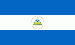
| Flag of Nicaragua | |
Originally inhabited by various indigenous cultures since ancient times, the region was conquered by the Spanish Empire in the 16th century. Nicaragua gained independence from Spain in 1821. The Mosquito Coast followed a different historical path, being colonized by the English in the 17th century and later coming under British rule. It became an autonomous territory of Nicaragua in 1860 and its northernmost part was transferred to Honduras in 1960. Since its independence, Nicaragua has undergone periods of political unrest, dictatorship, occupation and fiscal crisis, including the Nicaraguan Revolution of the 1960s and 1970s and the Contra War of the 1980s.
Currency / Language
| ISO | Currency | Symbol | Significant figures |
|---|---|---|---|
| NIO | Nicaraguan córdoba | C$ | 2 |
| ISO | Language |
|---|---|
| EN | English language |
| ES | Spanish language |


